
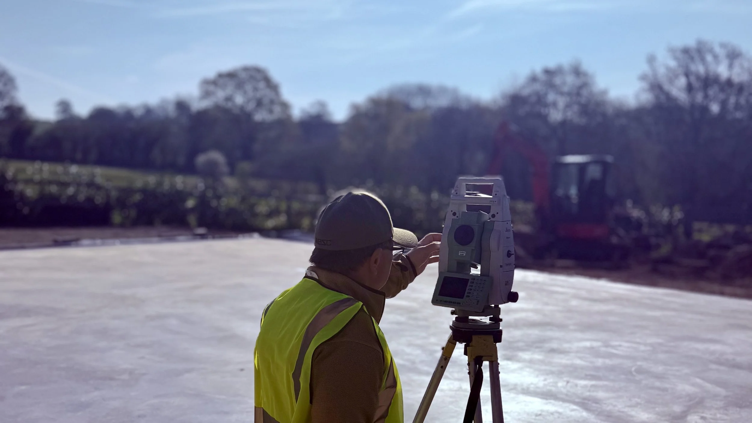
Instrument-grade site surveys;
Without the steel.
From groundworks and setting out to structural frames, brickwork, fit-out and beyond — we provide precise, verified site data that any trade or discipline can build from.
Accurate data for the whole project — not just the steel
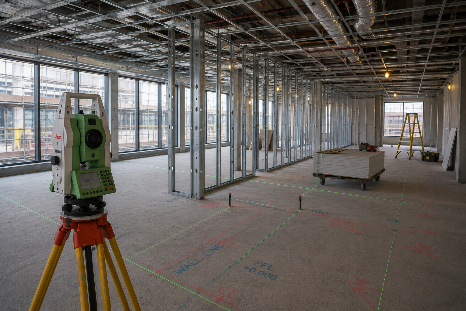
A totalstation is the most precise instrument available for site measurement. It captures exact positions, levels, angles and distances across a site in three dimensions — producing data that is repeatable, verifiable and traceable to a fixed datum.
We use this equipment on every project we deliver. The difference is that you don't need to be buying steel from us to benefit from it.
Whether you're a groundworker establishing foundations, a bricklayer setting out a return wall, a contractor checking structural levels, or a designer needing as-built conditions before detailing begins — the same instrument, and the same rigour, applies.
±2mm
Typical positional accuracy in controlled site conditions
CAD-ready
Deliverables in DXF, PDF and native formats — ready to use immediately
Where Totalstation Surveys Add Value
-
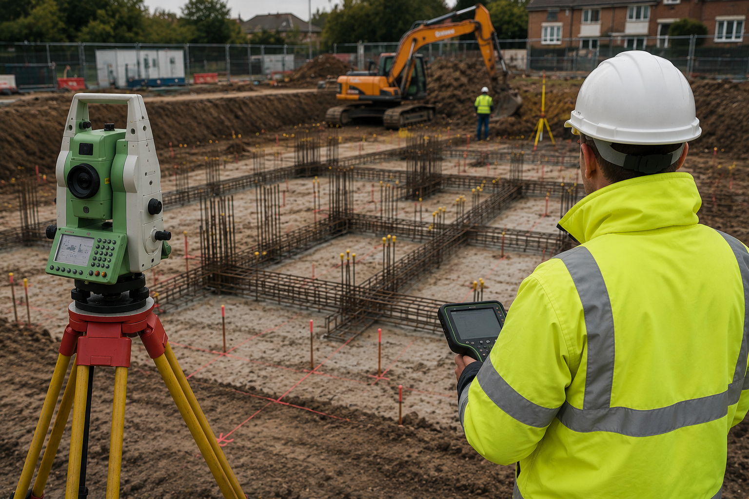
Groundworks & Foundations
Setting out foundation positions, pile locations, slab edges and excavation extents from design coordinates — ensuring groundworks are placed accurately before concrete is poured.
-
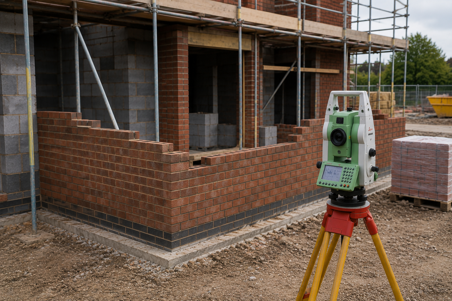
Brickwork & Masonry
Setting out brick lines, return walls, opening positions and coursing datums to ensure masonry is built plumb, square and in the right location from the first course up.
-
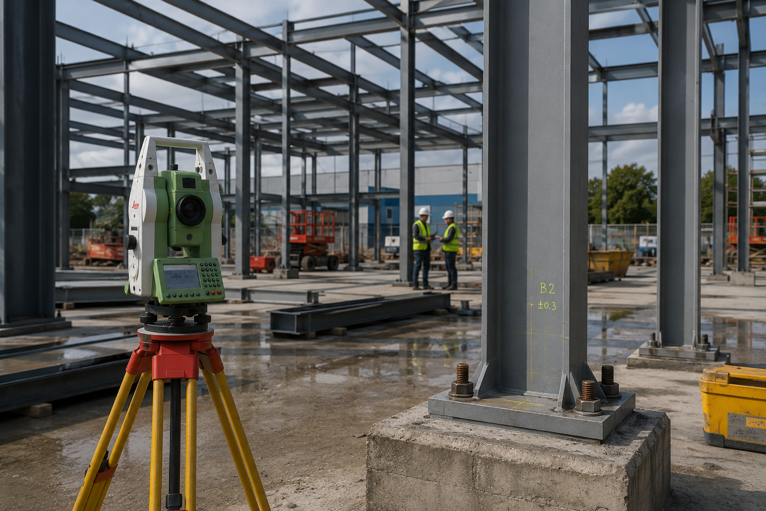
Structural Frames
Verification of column base positions, beam levels and connection interfaces before and after installation — confirming the structure is within tolerance before follow-on trades begin.
-
Fit-out & interiors
Setting out partition lines, ceiling grids and floor level surveys to support accurate fit-out installation and coordination between interior trades.
-

Facades & Glazing
Precise structural interface surveys to support facade templating and prefabrication — where even small deviations in the backing structure translate to costly problems at installation.
-

Measured & as-built surveys
Capturing existing conditions of buildings, spaces and structures to inform refurbishment design, planning submissions, and pre-acquisition due diligence.
What You Receive
CAD drawings (DXF / DWG)
1
Fully dimensioned plans, sections and elevations drawn from survey data — ready to import directly into your existing drawings or model.
PDF drawings
2
Clearly presented, scaled drawings for distribution across the design team or for submission to planning, building control or structural engineers.
Setting-out schedules
3
Coordinate-based schedules referenced to a national grid or site datum — formatted for direct use by groundworkers, steel fixers, bricklayers or contractors on site.
Level & deviation reports
4
Tabulated level data and deviation reports highlighting areas outside tolerance — giving you clear, actionable information before problems become programme issues.
Deliverables are agreed at enquiry stage and tailored to your project requirements. We don't issue data in a format you can't use.
Who We Work With
-
Architects & Designers
Verified existing conditions to underpin design from the outset — removing assumptions that cause expensive problems later in the programme.
-
Main Contractors
Setting-out control, level verification and as-built records across all trades — reducing risk and providing a reliable site baseline throughout construction.
-
Groundworkers
Precise foundation and slab setting-out from design coordinates, ensuring the project starts on solid ground before any concrete is placed.
-
Structural Engineers
As-built structural geometry to inform connection design, tolerance checks and coordination with other disciplines before fabrication or installation begins.
-
Specialist Subcontractors
Accurate interface surveys for facades, glazing, joinery and fit-out trades where precise existing conditions are essential to prefabrication and installation.
-
Developers
Pre-acquisition measured surveys, verified GIA data and existing conditions records to support due diligence, planning appraisals and feasibility assessments.
Need accurate site data?
Whatever stage your project is at, we can provide the survey data you need to move forward with confidence.